TargetTrack 4
TargetTrack 4 is our latest and most full featured radio direction finding software. TargetTrack 4 satisfies the needs of Signal and Communications Intelligence professionals, providing audio recording, evidentiary data, archival data, and the opportunity for post collection analysis of the collected data. Our modern user-friendly interface allows for simple set up and operation.
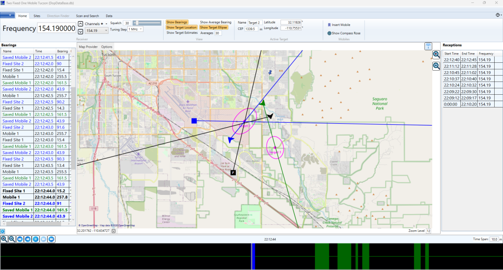

Measured bearings from a single or multiple direction finders are displayed on a map. Our Great Map facility allows use of data from a variety of sources including Open Street maps.
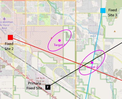
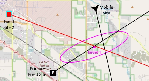
TargetTrack 4’s sophisticated digital signal processing identifies and estimates the position of multiple RF emitters. Ellipses around the target provide a measure of the uncertainty of the estimated position.
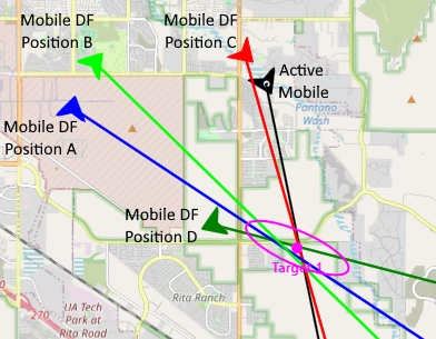
Using TargetTrack 4, a single mobile unit can determine the location of an RF emitter. As bearings are collected and entered from different positions, TargetTrack 4 computes the most probable location of the signal source. As the mobile RDF platform continues to move, additional bearings further refine and improve the accuracy of the estimated transmission location.
Fixed sites and mobiles can be networked to provide instantaneous estimated position of the RF emitter.
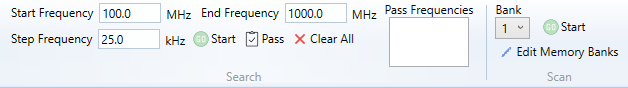
Simple setup of search and scan functions allows the user to search for signals within a giving frequency range or scan user programmed channels.
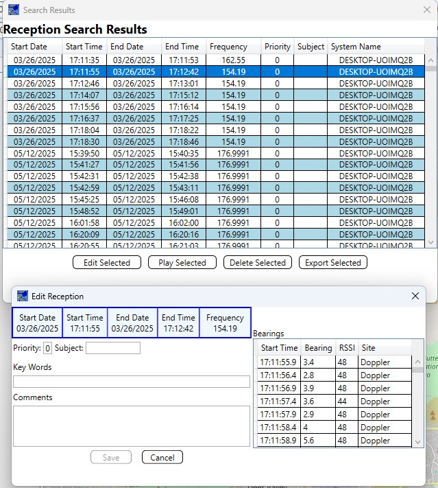
TargetTrack 4 provides a user-friendly display of the gathered reception data. The database supports searching across a variety of parameters. Users can tag the reception with user defined data for later retrieval. Playback of the reception is initiated by selecting the reception and pressing the Play Selected button. Data can be exported in JSON or XML format for off-line analysis or to be imported onto another computer running TargetTrack 4.
Geolocation Software – Common Technical Questions
How many bearings are required to geolocate an RF signal?
Geolocation requires two or more independent lines of bearing. These bearings may be collected simultaneously from multiple fixed sites or sequentially from different locations using a single mobile direction finder. Additional bearings improve confidence and reduce uncertainty.
Can a single mobile direction finder geolocate a transmitter?
Yes. By taking bearings from multiple physical locations over time, a single mobile direction finder can provide sufficient data for geolocation. As each bearing is added, the software recalculates the most likely transmitter position and updates the uncertainty estimate.
What does the 95% uncertainty ellipse represent?
The uncertainty ellipse represents the statistical confidence region for the estimated transmitter location. A 95% ellipse indicates the area where the signal source is most likely to be located based on bearing geometry, measurement accuracy, and signal conditions.
Can fixed and mobile direction finders be used together?
Yes. Fixed sites and mobile units can be networked together, allowing bearings from multiple platforms to be processed simultaneously. This enables faster geolocation and improves accuracy, particularly in dynamic or time-critical scenarios.
Can TargetTrack 4 track more than one RF emitter at a time?
Yes. TargetTrack 4 uses digital signal processing techniques to identify and estimate the positions of multiple RF emitters simultaneously, displaying individual position estimates and uncertainty regions for each detected signal.
What data can be exported from TargetTrack 4?
Collected reception data, bearing measurements, and metadata can be exported in JSON or XML formats. This allows off-line analysis, archival storage, or transfer to another system running TargetTrack 4.
If you need further information or would like a demonstration of the software, please contact us.