Applications
Doppler Systems radio direction finders have been used in a wide range of applications. A few of them are:
Finding Interference
Marine Vessel Tracking
Aircraft Tracking
Contact us for further information on how you can use our radio direction finders in your application.
Finding Interference
Malicious and unintentional interference is at least irritating and at most system threatening. It is important to find and eliminate the interference source as quickly as possible. Our direction finders offer multiple ways to find interference depending on the configuration of the direction finder or direction finding network.
Single Mobile Radio Direction Finder
The simplest and most inexpensive way to locate interference is by using a single mobile radio direction finder coupled with our homing software.
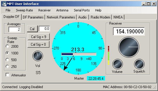
Using a single mobile direction finder requires the target transmitter to make multiple or continuous transmissions. The reception of a transmission by the direction finder results in a measurement of the direction of the transmitter relative to the vehicle. For instance, if the vehicle is traveling east and the transmitter is north of the vehicle, the direction finder would measure an angle of 270 degrees. If the transmission is occurring frequently, the operator can simply use the display on the MPT User Interface software application to monitor the direction and the strength of the transmission and direct the driver to the transmitter location. We refer to this as homing.
If the transmissions are infrequent or if it is unsafe to approach the transmitter location, then Doppler’s TargetTrack 4 software is used to provide an estimated location of the target transmitter. If possible, the direction finder is driven to a high point with a clear line-of-site to the transmitter and the frequency of interest is monitored.
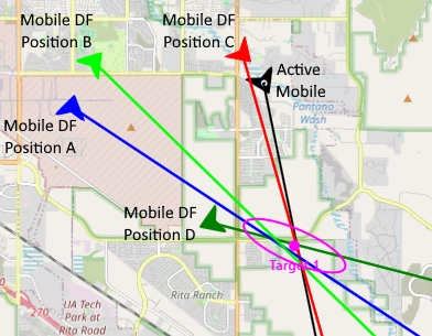
Upon receipt of a transmission, the operator determines if it is a signal of interest and presses the Insert key or Insert button to save the line-of-bearing (LOB) on the map. The operator then directs the driver to move to a different location and the process is repeated. Two saved LOBs from different locations allows TargetTrack 4 to estimate the location of the target and provide the operator with an uncertainty ellipse drawn around the estimate similar to the figure above. The uncertainty ellipse indicates that there is a 95% chance the transmitter is somewhere within the ellipse. TargetTrack 4 also calculates and displays the circular ellipse probability (CEP) enabling the operator to make a good determination of the target’s location. Although two LOBs are sufficient to estimate the target transmitter’s location, more measurements will result in a better estimate.
Multiple Radio Direction Finders
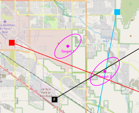
The location of a target transmitter can be estimated nearly instantaneously using multiple Doppler radio direction finders placed strategically around the area where the transmission is occurring. The direction finders can be fixed sites or mobiles connected via a TCP/IP network.
Doppler Systems’ TargetTrack 4 software combines the measurements from the various direction finders and displays the estimated location and the 95% ellipse on a map, which allows an operator to determine the precise location of the target. A minimum of two direction finders are required to provide expedient target location. However, to cover an area with no ambiguity, a minimum of three direction finders is required. The network of direction finders can be any combination of mobile and fixed site units.
Marine Vessel Tracking
Harbors are very busy places. Utilizing direction finding within the harbor environment provides bearing lines and position estimates for vessels, providing additional data for traffic monitoring. By positioning multiple fixed site direction finders around the port and networking them, our TargetTrack AIS software can geolocate ships within the harbor and display them on a map of the harbor. TargetTrack’s multi-target feature allows multiple ships transmitting on the same frequency to be tracked. With the addition of multiple direction finding processors, multiple frequencies can be simultaneously monitored and tracked.
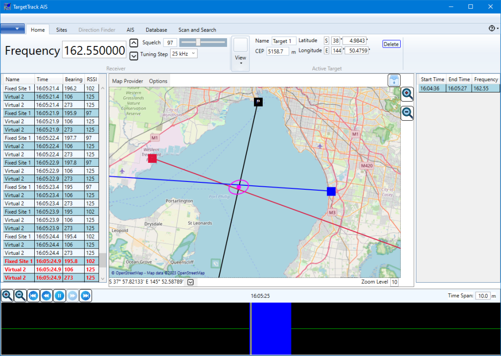
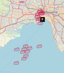
Additionally, TargetTrackAIS can be interfaced to an AIS receiver network and the position of the ships in the harbor provided by AIS will be displayed on the map simultaneously with the bearings. The screen shot left shows the AIS position of ships in Port Phillip Bay in Melbourne, Australia.
Aircraft Tracking
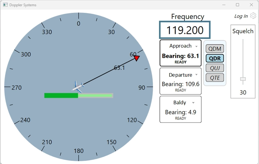
Throughout the world, airports utilize fixed site radio direction finders to track incoming and outgoing aircraft. Utilizing our multiple frequency monitoring feature, multiple aircraft on different frequencies can be tracked simultaneously using a single antenna, reducing cost and simplifying installation. As well, a TCP/IP connection to the direction finder is all that is required to route the data to the display, allowing the direction finder to be installed remotely from the tower.